
Melting Levels
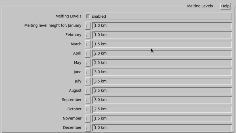
Enter an estimate for the melting level for each month. These are heights above mean sea level.
The monthly values are default values, we
assume you are changing these values dynamically while IRIS is running. The melting level is
used in several algorithms, such as fall speed correction and HydroClass.
These melting levels on an IRIS/Radar system are loaded on the RVP processor, and are also
recorded with the RAW radar data. This allows downstream product generators
to have access to the correct melting level.
 | If you are not using this feature, and the numbers are set incorrectly, they disable melting levels. |