

RTI: Range Time Indicator
RTI displays time along the horizontal axis and the vertical axis displays range from the radar.
An RTI can be used for any scan type (for example, PPI, RHI), but is most useful for manual scans or "searchlight" scans which are manual scans at a fixed position. Perhaps the best application is for vertical incidence scanning in which case the RTI product shows a time-height cross-section of the atmosphere.
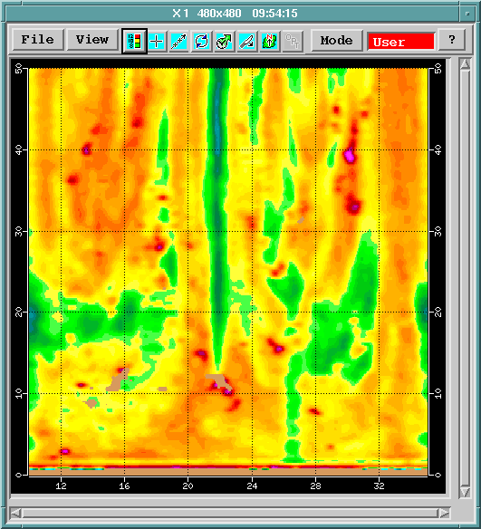
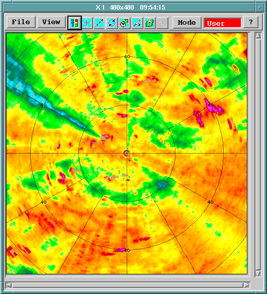
The following example shows an RTI and a PPI from the same situation. From both pictures, the maximum range is 50 km (31.1 mi) and the color scale is same. In this case, RTI has been made from a PPI task rotating 10° per second so the horizontal axis is both seconds from start and azimuth in tens of degrees. You can see the weak echo region near 220°, starting from 15 km (9.3 mi) in both. This can be beam blocking, which is probably easier to recognize in the RTI.
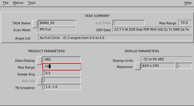
- Select .
- In Data:Display, choose any parameter available in the task configuration.
- In Max Range, type the maximum range in kilometers.
-
In Sweep Angle, select any of the elevation angles in the
task.
The angels are listed in the upper part of the menu.
-
In TR Smoother, define the smoother in XY directions of the
RTI image.
Typically, a small value is used for research purposes and a bigger value for customer products.
The time direction smoother is in seconds, the range direction in km.
-
In Resolution, choose from low, medium, high, and extra
high.
The default resolutions are rectangular to match the default rectangular window sizes of the Quick Look Window.