

PPI: Plan Position Indicator
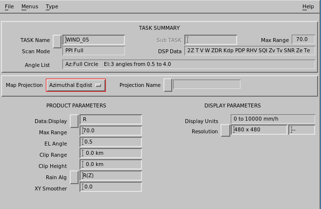
PPI is a full screen image used primarily for weather surveillance purposes.
PPI shows the distribution of the selected data parameter on a constant elevation angle surface, the classic radar display. IRIS PPI products are made as soon as the requested elevation sweep is completed rather than at the end of a volume scan.
A PPI shows data from one elevation, all azimuths. You can use it at the radar site for quality control.
- On the IRIS menu, select .
- Select .
- Select the button next to TASK name, and select a task from the list.
- Select the button next to Data:Display, and select a parameter to be displayed, typically Z for reflectivity.
-
Enter Maximum Range (km) and elevation angle which suit the task
you have selected.
You can see task information in upper part of the menu.
- Select and give a name for the PPI file.