TOPS: Echo Tops
TOPS is a color-coded contour map of the top of a selected dBZ level.
Either Z or ZT can be used as the basis for the estimate.
Heights are displayed in kilometers and
tenths of kilometers. A PPI volume scan task is required (either
FULL or SECTOR).
The TOPS product is an excellent indicator of severe weather and hail. For example, a 50 dBZ top 1 km (0.6 mi) above the freezing level can be produced only by a vigorous convective storm, and is most probably caused by the presence of hail. For air traffic applications, the search can be made using a lower threshold value, such as 10 dBZ, to determine the height of surrounding precipitation.
- Select .
-
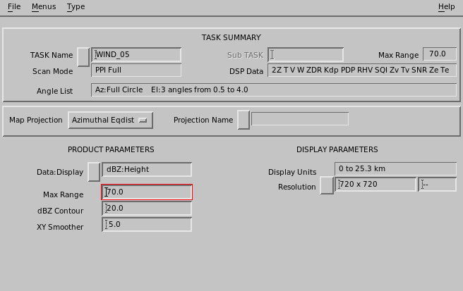
Configure the TOPS product:
- Data : Display
-
- Z Height
- T Height
The product can bederived from either Z or T data. If Z is selected as the Product Data parameter, but at run time only T is available (or vice versa), the product runs with the available data parameter.
- dBZ Contour
-
You can select the threshold contour level in dBZ. The TOPS algorithm then makes a downward search at constant range in cylindrical coordinates to determine when the threshold is crossed. It then interpolates in height to obtain the height of the threshold contour. Similar to the CAPPI, there must be an elevation tilt both above and below the contour to obtain a valid top height.
-
When the downward search detects a dBZ value greater than the threshold, there are the
following cases:
- Normal Case
- The dBZ value in the next higher ray (elevation angle) at the same surface range is used to interpolate the height of the contour that must lie in between.
- Undetected Echo Aloft
- If there is no detectable echo in the next higher ray aloft, then an interpolation cannot be done. However, a top must exist somewhere between these 2 rays. In this case, the top height is taken as the height of the point where the detection of dBZ >> Threshold was made.
- No Ray Aloft
-
If there is no higher elevation angle aloft, then a top exists somewhere aloft, but there is no information as to how much higher the top may be. In this case a special color (indicated by "???" in the legend) denotes that an indeterminate top exists.
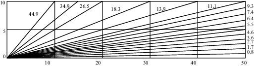
For example, at ranges less than 5 km (3.1 mi) in the volume scan shown in the following figure, the algorithm cannot determine tops that are above the highest elevation angle.
Figure 2. Example of 15-tilt Volume Scan